MAKE A MEME
View Large Image
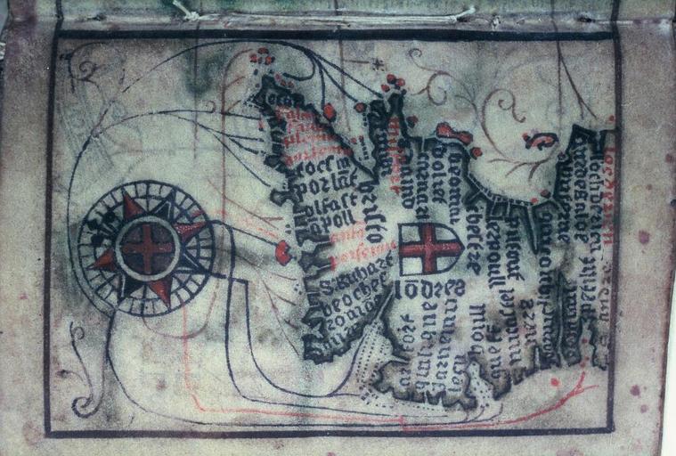
| View Original: | Bodleian Libraries, Map of England and Wales.jpg (1000x675) | |||
| Download: | Original | Medium | Small | Thumb |
| Courtesy of: | commons.wikimedia.org | More Like This | ||
| Keywords: Bodleian Libraries, Map of England and Wales.jpg French map of the coastline of England and Wales printed on parchment with wood blocks hand coloured from twelve leaves said to be unique leaf-size 105 x 75 mm; 35mm slide exhibition history Filmstrip Roll 205D frame 8; Source filename mapsxx003-aef-0001-0 object history object type Licensed-PD-Art PD-old-100 cc-by-4 0 place of creation place of discovery http //digital bodleian ox ac uk/inquire/p//e4ab739b-c3b7-4a84-9116-247a31bedaed Digital Bodleian Template Bodleian Libraries Map of England and Wales Uploaded with GWToolset Bodleian Libraries Map of England and Wales http //iiif bodleian ox ac uk/iiif/image/e4ab739b-c3b7-4a84-9116-247a31bedaed/full/ 1000 1000/0/default jpg Files uploaded by the Bodleian Libraries' Wikimedian In Residence Bodleian Maps Collection Old maps of Great Britain | ||||