MAKE A MEME
View Large Image

| View Original: | BlankMap-World-Subdivisions.PNG (1500x740) | |||
| Download: | Original | Medium | Small | Thumb |
| Courtesy of: | commons.wikimedia.org | More Like This | ||
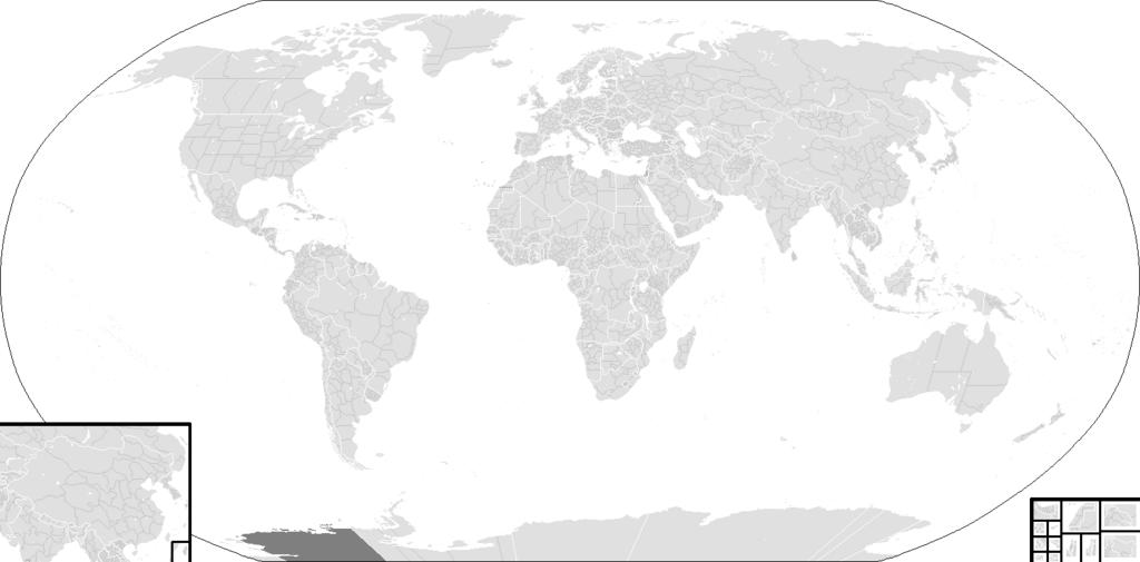
| Keywords: BlankMap-World-Subdivisions.PNG Blank Map World Secondary Political Divisions svg A blank world map showing subdivisions of the world Areas in black boxes are unrecognized countries or disputed territories Kashmir Feel free to fix subdivisions mainly Russia Mongolia and Kazakhstan If you use the subdivision maps for any other image I strongly advise changing the subdivision colours to suit your purposes eg In Photoshop use the bucket of paint thing with contiguous and anti-alias turned off and click on any subdivision border with your preferred colour The colours chosen here are to differentiate the types of borders not dictate use Carte du monde vierge montrant les subdivisions de premier niveau de chaque pays Les rĂ©gions encadrĂ©es en noir montrent des États non reconnus ou des territoires disputĂ©s comme le Cachemire Ne vous gĂŞnez pas pour arranger certaines limites de subdivisions ” notamment en Russie en Mongolie et au Kazakhstan Si vous utilisez cette carte pour faire une autre image il vous est vivement conseillĂ© d ™en changer les couleurs pour qu ™elles conviennent Ă votre usage ; ces couleurs-ci ne sont choisies que pour distinguer les diffĂ©rents types de frontières Provinces of South Africa see reference Provinces of Argentina see reference States and territories of Australia see reference Administrative divisions of Belarus see reference Subdivisions of Bosnia and Herzegovina see reference States of Brazil see reference Provinces and territories of Canada see reference Subdivisions of China see reference Provinces of the Democratic Republic of the Congo see reference States and territories of India see reference Provinces of Kazakhstan see reference Political divisions of Mexico see reference Subdivisions of Russia see reference Subdivisions of Serbia see http //www lib utexas edu/maps/europe/serbia_montenegro_pol_05 jpg reference; a 2005 CIA wall map of the former Serbia and Montenegro Governorates of Syria see reference Provinces of Turkmenistan see reference Provinces of Uzbekistan see reference Home Nations of the United Kingdom see reference U S states see reference 2006-12-19 see upload log BlankMap-World-Subdivisions1 png Key legend FFFFFF Water-bodies E0E0E0 Landmasses 7F7F7F Unclaimed Landmasses FFFFFF National Borders CACACA Subnational Borders Colours wikitable - center Name center center Decimal center Hex - center Water-bodies FFFFFF center 255 255 255 center FFFFFF - center Landmasses E0E0E0 center 224 224 224 center E0E0E0 - center Unclaimed Landmasses 7F7F7F center 127 127 127 center 7F7F7F - center National Borders FFFFFF center 255 255 255 center FFFFFF - center Subnational Borders CACACA center 202 202 202 center CACACA Blank maps of the world with subnational borders ImageNote 1 2 553 237 185 1480 740 2 Republic of China claims ImageNoteEnd 1 ImageNote 2 222 709 30 30 1480 740 2 Current Republic of China control ImageNoteEnd 2 ImageNote 4 1336 651 41 33 1480 740 2 Somaliland ImageNoteEnd 4 ImageNote 5 1354 683 22 22 1480 740 2 Northern Cyprus ImageNoteEnd 5 ImageNote 8 1378 655 46 43 1480 740 2 Sahrawi Arab Democratic Republic ImageNoteEnd 8 ImageNote 11 1334 683 20 22 1480 740 2 Kosovo ImageNoteEnd 11 ImageNote 12 1334 701 24 22 1480 740 2 Transnistria ImageNoteEnd 12 ImageNote 13 1354 707 20 19 1480 740 2 Abkhazia ImageNoteEnd 13 ImageNote 14 1339 725 17 13 1480 740 2 Nagorno-Karabakh ImageNoteEnd 14 ImageNote 15 1356 727 20 11 1480 740 2 South Ossetia ImageNoteEnd 15 ImageNote 16 1378 701 26 37 1480 740 2 As Israel claims ImageNoteEnd 16 ImageNote 17 1406 703 22 35 1480 740 2 As Palestine claims ImageNoteEnd 17 ImageNote 18 1428 659 50 44 1480 740 2 Pakistani claims on Kashmir ImageNoteEnd 18 ImageNote 19 1425 699 54 39 1480 740 2 Indian claims on Kashmir ImageNoteEnd 19 | ||||