MAKE A MEME
View Large Image

| View Original: | Beaufort Sea and disputed waters.png (512x602) | |||
| Download: | Original | Medium | Small | Thumb |
| Courtesy of: | commons.wikimedia.org | More Like This | ||
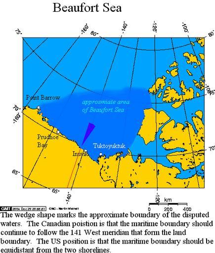
| Keywords: Beaufort Sea and disputed waters.png Área aproximada del Mar de Beaufort y el área en disputa Beaufort Sea and the disputed waters The wedge shaped area on this map is the approximate area of the waters in dispute between the Yukon and Alaska The longitude and latitudes of the communities follow -148 4054 70 2254 Prudhoe Bay -156 7358 71 3003 Barrow -139 5011 69 5539 Inuvik -135 3302 69 6212 Tuktoyuktuk Secondary source en Image Beaufort_Sea_and_disputed_waters png Copyright owner Geo Swan 2005-05-14 own assumed Mattes GFDL relicense cc-sa Maps of the Beaufort Sea Maps of disputed territories in North America Uploads by Mattes from external sources | ||||