MAKE A MEME
View Large Image
| View Original: | Batz-ChickasawVillages1736_SEM236C_F329014.jpg (2679x3920) | |||
| Download: | Original | Medium | Small | Thumb |
| Courtesy of: | commons.wikimedia.org | More Like This | ||
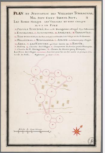
| Keywords: Batz-ChickasawVillages1736 SEM236C F329014.jpg http //bd archivescanadafrance org/acf/view xsp qid sdx_q0 p 1 b acfdb id FRCAOM_F3290_14 This map is described by Gregory A Waselkov in Indian Maps of the Southeast which is published in Powhatan's Mantle Indians in the Colonial Southeast ISBN 08032986 pp 483-486 1736 Creator Alexandre de Batz This image is in the public domain due to its age PD-old-100 Chickasaw Campaign of 1736 Alexandre de Batz | ||||