MAKE A MEME
View Large Image
| View Original: | Banat_Josephinische_Landaufnahme_pg037.jpg (8456x5776) | |||
| Download: | Original | Medium | Small | Thumb |
| Courtesy of: | commons.wikimedia.org | More Like This | ||
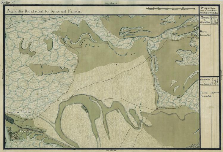
| Keywords: Banat Josephinische Landaufnahme pg037.jpg wikitable style margin 1em auto 1em auto width 80 Name shown on the map<br>Nume din hart─ā Administrative unit<br>Unitate administrativ─ā Romanian name<br>Numele rom├ónesc Hungarian name<br>Numele unguresc German name<br>Numele german Serbian name<br>Numele s├órbesc Country today<br>┼óara de ast─āzi - Becsey Toront├Īl megye<br>Komitat Torontal<br>Comitatul Torontal Novi Be─Źe ├Üjbecse Becse T├Čr├Čkbecse ├®s Aracs ├ōbecse Neu-Betsche und Aratsch ą ąŠą▓ąĖ ąæąĄčćąĄčś Szerbia ├®s Montenegr├│ - Franiova Militair Toront├Īl megye Novi Be─Źe Aracs Franyova Aratsch Vranjevo today part of Novi Be─Źej Szerbia ├®s Montenegr├│<br>Serbien und Montenegro<br>Serbia ┼¤i Muntenegru - Banatul ├«n h─ār┼Żile iozefine 1769-72 Josephinische Landaufnahme pg037 de Das Banat in Josephinische Landesaufnahme 1769-72 Josephinische Landaufnahme pg037 en The Banat region in the cadastral maps Josephinische Landesaufnahme 1769-72 Josephinische Landaufnahme pg037 ├¢sterreichisches Staatsarchiv Kriegsarchiv Historische Milit├żrkarte der ├Čsterreichisch-ungarischen Monarchie 1769 - 72 PD-old-100 Clickable map of the Banat region BanatJosephinischeLandaufnahme 1769-72 Josephinische Landaufnahme Novi Be─Źej | ||||