MAKE A MEME
View Large Image

| View Original: | Automating_Flow_Map_Layout.jpg (823x652) | |||
| Download: | Original | Medium | Small | Thumb |
| Courtesy of: | commons.wikimedia.org | More Like This | ||
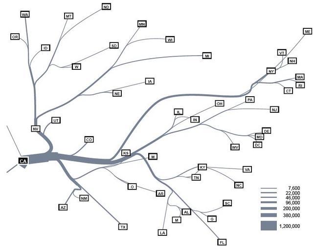
| Keywords: Automating Flow Map Layout.jpg en Automating Flow Map Layout of California migration 1995-2000 U S Census This map shows the distribution of people leaving California for other states The automatic layout feature of the system has slightly moved the positions of some state labels from their absolute geographic location http //nvac pnl gov/vacviews/VACViews_feb07 pdf VAC Vieuws feb 2007 op nvac pnl gov p 9 VACnews 2007-02 PD-USGov Flow maps Information visualization Visual analytics Tree charts | ||||