MAKE A MEME
View Large Image

| View Original: | Atlas_Van_der_Hagen-KW1049B13_037-XANSI._IMPERII_SINARVM_PROVINCIA_SECVNDA..jpeg (5500x4631) | |||
| Download: | Original | Medium | Small | Thumb |
| Courtesy of: | commons.wikimedia.org | More Like This | ||
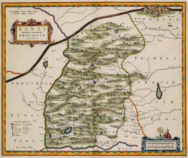
| Keywords: Atlas Van der Hagen-KW1049B13 037-XANSI. IMPERII SINARVM PROVINCIA SECVNDA..jpeg of the Atlas Van der Hagen in the catalogue of the KB http //opc4 kb nl/DB 1/TTL 1/LNG EN/PPN PPN 353012750 Creator Martino_Martini Author Martino Martini Publisher Creator Joan Blaeu Author Martino Martini Publisher Creator Joan Blaeu credit line 1655 Deze kaart van de Chinese provincie Shanxi werd samengesteld door de Italiaanse missionaris Martino Martini 1614-1661 De kaart werd in 1655 opgenomen in de Atlas Sinensis van Joan Blaeu 1598-1673 Shansi grenst aan de noordzijde aan de Grote Muur die op deze kaart sterk is geaccentueerd The map of the Chinese province Shanxi was part of an atlas of China composed by the Italian missionary Martino Martini 1614-1661 On his way back to Rome Martini stopped in Amsterdam where he sold his atlas to Joan Blaeu 1598-1673 From 1655 Blaeu published Martinis atlas as the Atlas Sinensis the atlas of China in several languages The Atlas Sinensis also became an integral part of the Atlas Maior in 1662 The north of Shanxi borders the Great Wall and is clearly visible on the map 40 x 50 cm exhibition history Institution Koninklijke Bibliotheek kopergravure Technique copper engraving KW1049B13_037 - Volume 1 Joan Blaeu - Martino Martini Information field Depicted locations Shanxi - China object history object type Kaart Map PD-old-100 place of creation Amsterdam place of discovery Source page at the http //resolver kb nl/resolve urn urn gvn KONB01 385 Geheugen van Nederland / Memory of the Netherlands website Koninklijke Bibliotheek XANSI IMPERII SINARVM PROVINCIA SECVNDA Uploaded with GWToolset Atlas Van der Hagen-KW1049B13_037-XANSI IMPERII SINARVM PROVINCIA SECVNDA http //resolver kb nl/resolve urn urn gvn KONB01 1049B13_037 size large Atlas van der Hagen | ||||