MAKE A MEME
View Large Image

| View Original: | Atlas_Van_der_Hagen-KW1049B10_005-NOVA_ZEMBLA.jpeg (5500x4307) | |||
| Download: | Original | Medium | Small | Thumb |
| Courtesy of: | commons.wikimedia.org | More Like This | ||
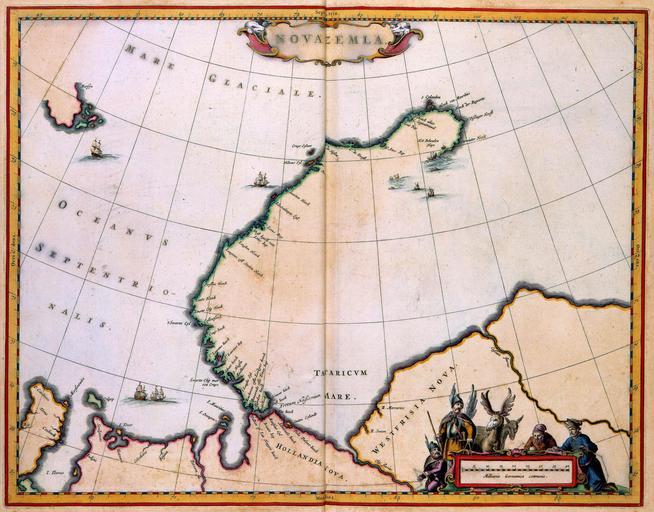
| Keywords: Atlas Van der Hagen-KW1049B10 005-NOVA ZEMBLA.jpeg of the Atlas Van der Hagen in the catalogue of the KB http //opc4 kb nl/DB 1/TTL 1/LNG EN/PPN PPN 353012750 Publisher Johannes van Keulen Publisher Johannes van Keulen credit line ca 1680 Deze kaart van Nova Zembla werd omstreeks 1680 gepubliceerd in een zeeatlas van Johannes van Keulen 1654-1715 Een kaart van het eiland in de Noordelijke IJszee sprak zeer tot de verbeelding van de toenmalige kaartlezer vooral door de herinnering aan de ontberingen die de eerste Nederlandse poolreiziger Willem Barendts ca 1550-1597 daar had beleefd Tijdens zijn laatste bezoek aan het eiland in 1597 raakte Barendtsz met zijn schip vast in het ijs en moest hij volledig onvoorbereid met zijn bemanning op Nova Zembla overwinteren Johannes van Keulen 1654-1715 published this map of Nova Zembla about 1680 in a nautical atlas Contemporary map users were intrigued by a map of the island in the Arctic Ocean because of the remembrance of the rigours of the arctic winter suffered by the first Dutch arctic explorer Willem Barentsz c 1550-1597 During his last visit to the island in 1597 Barendtsz got stuck in the ice and while he was unprepared he and his crew had to stay the winter in Nova Zembla 38 x 49 cm exhibition history Institution Koninklijke Bibliotheek kopergravure Technique copper engraving KW1049B10_005 - Volume 1 Willem Barentsz - Johannes van Keulen Information field Depicted locations Nova Zembla - Arctic Ocean object history object type Kaart Map PD-old-100 place of creation Amsterdam place of discovery Source page at the http //resolver kb nl/resolve urn urn gvn KONB01 5 Geheugen van Nederland / Memory of the Netherlands website Koninklijke Bibliotheek NOVA ZEMBLA Uploaded with GWToolset Atlas Van der Hagen-KW1049B10_005-NOVA ZEMBLA http //resolver kb nl/resolve urn urn gvn KONB01 1049B10_005 size large Atlas van der Hagen | ||||