MAKE A MEME
View Large Image
| View Original: | Atlas_Van_der_Hagen-KW1049B12_035-GOUVERNEMENT_GENERAL_DV_PAYS_ORLEANOIS.jpeg (5500x4362) | |||
| Download: | Original | Medium | Small | Thumb |
| Courtesy of: | commons.wikimedia.org | More Like This | ||
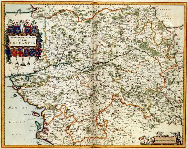
| Keywords: Atlas Van der Hagen-KW1049B12 035-GOUVERNEMENT GENERAL DV PAYS ORLEANOIS.jpeg of the Atlas Van der Hagen in the catalogue of the KB http //opc4 kb nl/DB 1/TTL 1/LNG EN/PPN PPN 353012750 Publisher Creator Joan Blaeu Publisher Creator Joan Blaeu credit line 1662 Deze kaart van de landstreek Orleans werd in 1662 uitgegeven door Joan Blaeu 1598-1673 De kaart komt voor in het 7de deel van de Atlas Maior This map of the lands around Orleans was published in 1662 by Joan Blaeu 1598-1673 The map is included in the seventh volume of his Atlas Maior 47 x 60 cm exhibition history Institution Koninklijke Bibliotheek kopergravure Technique copper engraving KW1049B12_035 - Volume 1 Joan Blaeu Information field Depicted locations Orleans - France object history object type Kaart Map PD-old-100 place of creation Amsterdam place of discovery Source page at the http //resolver kb nl/resolve urn urn gvn KONB01 273 Geheugen van Nederland / Memory of the Netherlands website Koninklijke Bibliotheek GOUVERNEMENT GENERAL DV PAYS ORLEANOIS Uploaded with GWToolset Atlas Van der Hagen-KW1049B12_035-GOUVERNEMENT GENERAL DV PAYS ORLEANOIS http //resolver kb nl/resolve urn urn gvn KONB01 1049B12_035 size large Atlas van der Hagen | ||||