MAKE A MEME
View Large Image

| View Original: | Atlas_Van_der_Hagen-KW1049B13_095-PRAEFECTURAE_PARANAMBUCAE_PARS_BOREALIS,_una_cum_PRAEFECTURA_de_ITAMARACA.jpeg (5500x4309) | |||
| Download: | Original | Medium | Small | Thumb |
| Courtesy of: | commons.wikimedia.org | More Like This | ||
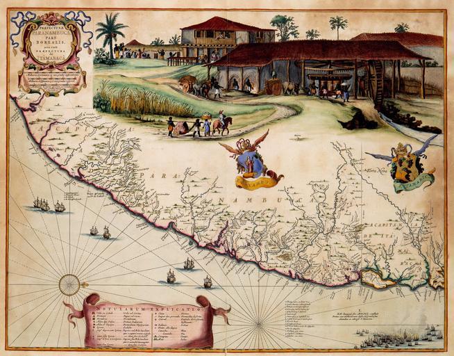
| Keywords: Atlas Van der Hagen-KW1049B13 095-PRAEFECTURAE PARANAMBUCAE PARS BOREALIS, una cum PRAEFECTURA de ITAMARACA.jpeg of the Atlas Van der Hagen in the catalogue of the KB http //opc4 kb nl/DB 1/TTL 1/LNG EN/PPN PPN 353012750 Creator Cornelis Goliath Creator Georg Marcgraf Author Cornelis Goliath en Georg Marcgraf Publisher Creator Joan Blaeu Author Cornelis Goliath en Georg Marcgraf Publisher Creator Joan Blaeu credit line 1662 Tussen 1630 en 1654 werd een groot deel van Brazilië door de Nederlanders bezet Gedurende deze periode werd het gebied in kaart gebracht door de kartografen Cornelis Goliath overleden 1667/1668 en Georg Marcgraf In 1643 verwerken zij de resultaten van deze opname in een fraaie wandkaart Naar het voorbeeld van die kaart publiceerde Joan Blaeu 1598-1673 in 1662 deze atlaskaart Between 1630 and 1654 a large part of Brazil was occupied by the Dutch In this period the area was surveyed and mapped by the cartographers Cornelis Goliath deceased 1667/1668 and Georg Marcgraf The results were compiled in a decorative wall map in 1643 Joan Blaeu 1598-1673 used the wall map as his source for this map in 1662 42 x 54 cm exhibition history Institution Koninklijke Bibliotheek kopergravure Technique copper engraving KW1049B13_095 - Volume 1 Joan Blaeu - Cornelis Goliath - Georg Marcgraf Information field Depicted locations South-America - Brazil object history object type Kaart Map PD-old-100 place of creation Amsterdam place of discovery Source page at the http //resolver kb nl/resolve urn urn gvn KONB01 444 Geheugen van Nederland / Memory of the Netherlands website Koninklijke Bibliotheek PRAEFECTURAE PARANAMBUCAE PARS BOREALIS una cum PRAEFECTURA de ITAMARACA Uploaded with GWToolset Atlas Van der Hagen-KW1049B13_095-PRAEFECTURAE PARANAMBUCAE PARS BOREALIS una cum PRAEFECTURA de ITAMARACA http //resolver kb nl/resolve urn urn gvn KONB01 1049B13_095 size large Atlas van der Hagen Pernambuco | ||||