MAKE A MEME
View Large Image

| View Original: | AshfieldNSWmap1850s.jpg (843x503) | |||
| Download: | Original | Medium | Small | Thumb |
| Courtesy of: | commons.wikimedia.org | More Like This | ||
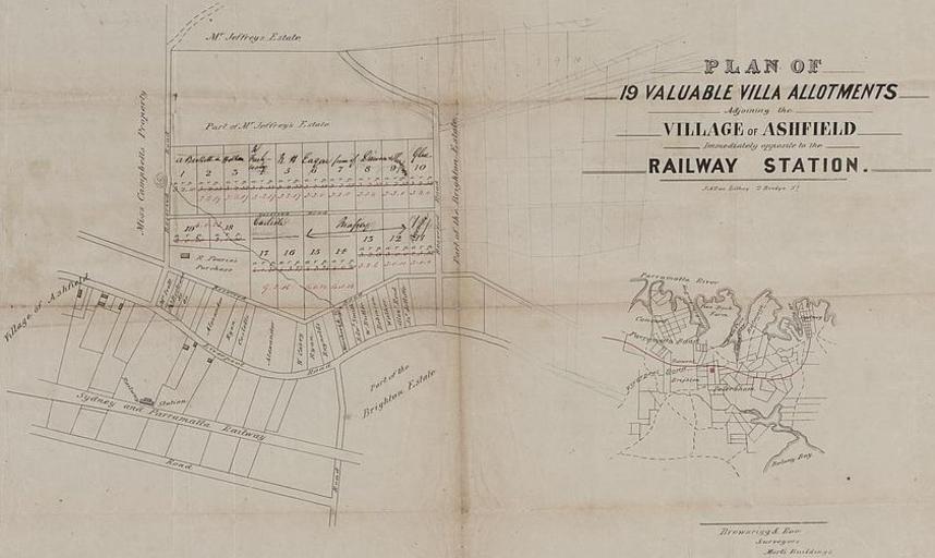
| Keywords: AshfieldNSWmap1850s.jpg en Plan of 19 allotments for sale in Ashfield in the 1850s in an area between Holden St Norton St Milton St and Park Ln Under Australian law all photographs taken in Australia before 1955 are in the public domain This image is in the public domain under both Australian copyright law and US copyright law Accessed from National Library of Australia http //nla gov au/nla map-f526-v jpg PD-Australia Original upload log en wikipedia FtCG page en wikipedia AshfieldNSWmap1850s jpg wikitable - 06 06 30 March 2007 843 × 503 107 642 bytes Crico w en <nowiki> Plan of 19 allotments for sale in Ashfield in the 1850s in an area between Holden St Norton St Milton St and Park Ln Under Australian law all photographs taken in Australia before 1955 are in the public domain This image is in the public domain unde </nowiki> - 06 02 30 March 2007 983 × 706 144 964 bytes Crico w en <nowiki> Summary Plan of 19 allotments for sale in Ashfield in the 1850s in an area between Holden St Norton St Milton St and Park Ln Under Australian law all photographs taken in Australia before 1955 are in the public domain This image is in the publ </nowiki> - 05 42 30 March 2007 1 000 × 737 93 756 bytes Crico w en <nowiki> Plan of 19 allotments for sale in Ashfield in the 1850s in an area between Holden St Norton St Milton St and Park Ln Under Australian law all photographs taken in Australia before 1955 are in the public domain This image is in the public domain unde </nowiki> Ashfield Western Australia | ||||