MAKE A MEME
View Large Image
| View Original: | Arabian_tectonic_plate_overview_map.png (213x203) | |||
| Download: | Original | Medium | Small | Thumb |
| Courtesy of: | commons.wikimedia.org | More Like This | ||
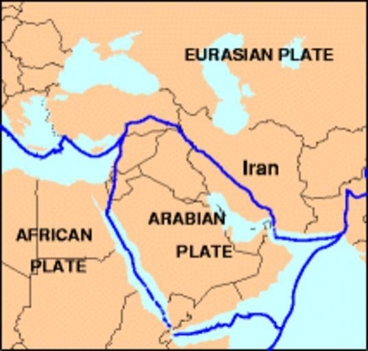
| Keywords: Arabian tectonic plate overview map.png en Overview map of the Arabian tectonic plate date uploaded 2012-01-17 http //neic usgs gov/neis/gifs/iran_plates gif Used in document http //neic usgs gov/neis/eq_depot/2004/eq_040528/neic_jaan_ts html Tectonic Summary Magnitude 6 3 NORTHERN IRAN 2004 May 28 12 38 46 UTC U S Geological Survey PD-USGov Arabian tectonic plate Original upload log wikitable - - 2012-01-17 13 29 04 213 × 203 14751 bytes Rwendland <nowiki></nowiki> | ||||