MAKE A MEME
View Large Image

| View Original: | AMH-8620-NA Map of the east coast of North America.jpg (2400x2197) | |||
| Download: | Original | Medium | Small | Thumb |
| Courtesy of: | commons.wikimedia.org | More Like This | ||
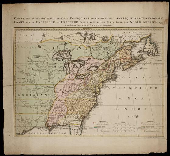
| Keywords: AMH-8620-NA Map of the east coast of North America.jpg Artwork nl Kaart van de oostkust van Noord Amerika nl Kaart van de oostkust van Noord Amerika Titel Catalogus Leupe NA Kaart van de Engelsche en Fransche Bezittingen in het vaste land van Noord America Carte des Possessions Angloises Françoises du Continent de l'Amerique Septentrionale / Kaart van de Engelsche en Fransche Bezittingen in het Vaste Land van Noord America Cf Nationaal Archief Den Haag inv nr 1381 en Map of the east coast of North America Title in the Leupe Catalogue NA Kaart van de Engelsche en Fransche Bezittingen in het vaste land van Noord America Carte des Possessions Angloises Françoises du Continent de l'Amerique Septentrionale / Kaart van de Engelsche en Fransche Bezittingen in het Vaste Land van Noord America Cf National Archives The Hague inv nr 1381 Atlas of Mutual Heritage na http //www atlasofmutualheritage nl/en/object/ id 8620 Source at the Atlas of Mutual Heritage - http //www gahetna nl/collectie/archief/inventaris/index/eadid/4 VEL/inventarisnr/1382/level/file Source at the Nationaal Archief en Subjects chart / map / plan nl Onderwerpen plattegrond / kaart en Post this image is related to a WIC trading post called http //www atlasofmutualheritage nl/en/post/ id 948 New York Inscription Carte des Possessions Angloises Françoises du Continent de l'Amerique Septentrionale / Kaart van de Engelsche en Fransche Bezittingen in het Vaste Land van Noord America author à Amsterdam Chez R et J Ottens Geográphes nl 1755 Creator J Ottens Creator Reinier Ottens nl J Ottens uitgever Reinier Ottens uitgever en J Ottens publisher Reinier Ottens publisher Institution Nationaal Archief nl koperdruk op papier en copperplate printing on paper Size cm 61 9 57 5 accession number NL-HaNA_4 VEL_1382 old number VEL1382 PD-Art-100 Maps of the West-Indische Compagnie 1755 | ||||