MAKE A MEME
View Large Image
| View Original: | AMH-8061-KB_Map_of_Cape_Corso_with_the_British_fort.jpg (2400x1793) | |||
| Download: | Original | Medium | Small | Thumb |
| Courtesy of: | commons.wikimedia.org | More Like This | ||
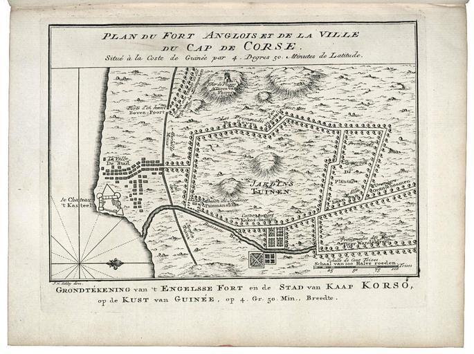
| Keywords: AMH-8061-KB Map of Cape Corso with the British fort.jpg Artwork nl Plattegrond van Caap Corso met het Engelse fort nl Plattegrond van Caap Corso met het Engelse fort Plan du Fort Anglois et de la Ville du Cap de Corse / Situé à la Coste de Guinée par 4 Degres 50 Minutes de Latitude Het fort op de plattegrond is voor het in 1664 in Engelse handen kwam door de WIC bezet geweest en Map of Cape Corso with the British fort Plan du Fort Anglois et de la Ville du Cap de Corse / Situé à la Coste de Guinée par 4 Degres 50 Minutes de Latitude The fort shown on the map was occupied by the WIC before it fell into English hands in 1664 Atlas of Mutual Heritage kb http //www atlasofmutualheritage nl/en/object/ id 8061 Source at the Atlas of Mutual Heritage en Subjects compass / dial chart / map / plan fortification tower garden / ornamental garden nl Onderwerpen kompas / windroos plattegrond / kaart vesting toren tuin / siertuin en Post this image is related to a WIC trading post called http //www atlasofmutualheritage nl/en/post/ id 688 Cape Coast Inscription Plan du Fort Anglois et de la Ville du Cap de Corse author J v Schley direx nl 1747 Creator Pierre d' Hondt Creator Jacobus van der Schley nl Pierre d' Hondt uitgever Jacobus van der Schley graveur / etser en Pierre d' Hondt publisher Jacobus van der Schley engraver / etcher Institution Koninklijke Bibliotheek nl gravure op papier en engraving on paper Size cm 14 19 accession number 693 C 6 dl V to p 134 PD-Art-100 Maps of the West-Indische Compagnie 1747 | ||||