MAKE A MEME
View Large Image

| View Original: | AMH-7930-KB_Map_of_Japan,_China_and_Korea.jpg (2400x1815) | |||
| Download: | Original | Medium | Small | Thumb |
| Courtesy of: | commons.wikimedia.org | More Like This | ||
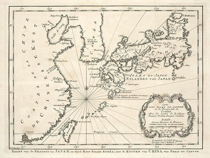
| Keywords: AMH-7930-KB Map of Japan, China and Korea.jpg Artwork nl Kaart van Japan China en Korea nl Kaart van Japan China en Korea Kaart van de Eilanden van Japan en van 't Half Eiland Koréa; met de Kusten van China van Pekin tot Canton Carte Des Isles Du Japon et la Presqu Isle de Coree Avec les Costes de la Chine Depuis Pekin Jusqu'a Canton en Map of Japan China and Korea Kaart van de Eilanden van Japan en van 't Half Eiland Kor a; met de Kusten van China van Pekin tot Canton Carte Des Isles Du Japon et la Presqu Isle de Coree Avec les Costes de la Chine Depuis Pekin Jusqu'a Canton Atlas of Mutual Heritage kb http //www atlasofmutualheritage nl/en/object/ id 7930 Source at the Atlas of Mutual Heritage en Subjects chart / map / plan compass / dial banderole / cartouche / ornamentation nl Onderwerpen plattegrond / kaart kompas / windroos banderol / cartouche / versiering en Post this image is related to a VOC trading post called http //www atlasofmutualheritage nl/en/post/ id 333 Nagasaki Inscription Kaart van de Eilanden van Japan en van 't Half Eiland Koréa author J v Schley direx nl 1747 Creator Jacques Nicolas Bellin Creator Jacobus van der Schley Creator Pierre d' Hondt nl Jacques Nicolas Bellin landmeter / kaartenmaker Jacobus van der Schley direxit Pierre d' Hondt uitgever en Jacques Nicolas Bellin land surveyor / mapmaker Jacobus van der Schley direxit Pierre d' Hondt publisher Institution Koninklijke Bibliotheek nl gravure op papier en engraving on paper Size cm 16 5 21 5 accession number 693 C 6 dl II na p 372 PD-Art-100 Maps of the Dutch East India Company - Korea Maps of the Dutch East India Company - Japan Maps of the Dutch East India Company - Taiwan Maps of the Dutch East India Company - China 1747 | ||||