MAKE A MEME
View Large Image
| View Original: | AMH-7872-KB_Map_of_Angola,_Kongo_and_Benguela.jpg (2400x1869) | |||
| Download: | Original | Medium | Small | Thumb |
| Courtesy of: | commons.wikimedia.org | More Like This | ||
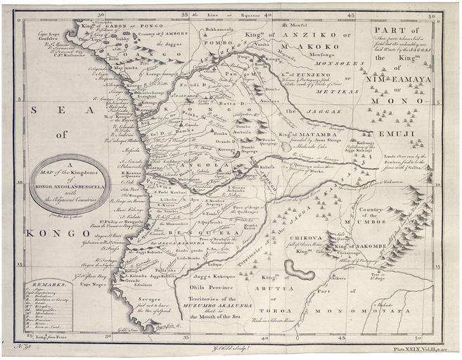
| Keywords: AMH-7872-KB Map of Angola, Kongo and Benguela.jpg Artwork nl Kaart van Angola Kongo en Benguela nl Kaart van Angola Kongo en Benguela Map of the Kingdoms of Kongo Angola Benguela with the Adjacent Countries Linksonder No 98 Plate XXIX Vol III p 212 en Map of Angola Kongo and Benguela Map of the Kingdoms of Kongo Angola Benguela with the Adjacent Countries Bottom left No 98 Plate XXIX Vol III p 212 Atlas of Mutual Heritage kb http //www atlasofmutualheritage nl/en/object/ id 7872 Source at the Atlas of Mutual Heritage en Subjects chart / map / plan banderole / cartouche / ornamentation key nl Onderwerpen plattegrond / kaart banderol / cartouche / versiering legenda en Post this image is related to a WIC trading post called http //www atlasofmutualheritage nl/en/post/ id 953 Mayumba Inscription Map of the Kingdoms of Kongo Angola Benguela with the Adjacent Countries author G Child Sculpt nl circa 1745 Creator G Child nl G Child graveur / etser Anoniem / Anonymous landmeter / kaartenmaker en G Child engraver / etcher Anoniem / Anonymous land surveyor / mapmaker Institution Koninklijke Bibliotheek nl gravure op papier en engraving on paper Size cm 26 33 5 accession number 3032 B 12 na p 212 PD-Art-100 Maps of the West-Indische Compagnie 1745 | ||||