MAKE A MEME
View Large Image
| View Original: | AMH-6920-KB_Map_of_South_East_Asia_with_an_inset_showing_the_Botton_Strait.jpg (2400x1723) | |||
| Download: | Original | Medium | Small | Thumb |
| Courtesy of: | commons.wikimedia.org | More Like This | ||
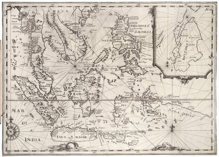
| Keywords: AMH-6920-KB Map of South East Asia with an inset showing the Botton Strait.jpg Artwork nl Kaart van Zuid-Oost Azië met een inzet van de straat van Botton nl Kaart van Zuid-Oost Azië met een inzet van de straat van Botton Cf Koninklijke Bibliotheek inv nr 496 D 12 deel II p 209 Rechtsboven No 19 en Map of South East Asia featuring an insert showing the Botton Strait Cf Koninklijke Bibliotheek inv nr 496 D 12 part II p 209 Top right No 19 Atlas of Mutual Heritage kb http //www atlasofmutualheritage nl/en/object/ id 6920 Source at the Atlas of Mutual Heritage en Subjects chart / map / plan compass / dial banderole / cartouche / ornamentation fauna nl Onderwerpen plattegrond / kaart kompas / windroos banderol / cartouche / versiering fauna circa 1621 Creator Jan Jansz nl Anoniem / Anonymous landmeter / kaartenmaker Jan Jansz uitgever en Anoniem / Anonymous land surveyor / mapmaker Jan Jansz publisher Institution Koninklijke Bibliotheek nl gravure op papier en engraving on paper Size cm 32 5 45 5 accession number 551 J 49 na p 114 PD-Art-100 Old maps of the Dutch East India Company 1621 | ||||