MAKE A MEME
View Large Image

| View Original: | AMH-6784-NA_Map_of_Pernambuco.jpg (2400x1869) | |||
| Download: | Original | Medium | Small | Thumb |
| Courtesy of: | commons.wikimedia.org | More Like This | ||
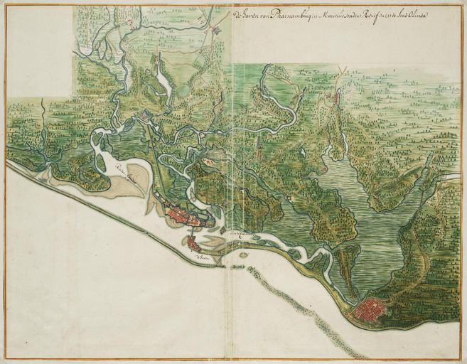
| Keywords: AMH-6784-NA Map of Pernambuco.jpg Artwork nl Kaart van Pernambuco nl Titel catalogus Leupe NA Kaart van de haven van Pharnambucq Maritiusstad Recif en de stad Olinda Kaart van Pernambuco De haven van Pharnambucq Legenda 1 Maritius Stad 2 Recif en 3 de Stad Olinda Linksboven is een kader uitgespaard dat nooit is ingevuld Bijzonderheden de kaart hoort bij de Atlas Vingboons en Title in the Leupe catalogue NA Kaart van de haven van Pharnambucq Maritiusstad Recif en de stad Olinda Map of Pernambuco De haven van Pharnambucq Key 1 Maritius Stad 2 Recif en 3 de Stad Olinda Top left a box has been created that has not been filled in Remarks the map is contained in the Vingboons Atlas Atlas of Mutual Heritage na http //www atlasofmutualheritage nl/en/object/ id 6784 Source at the Atlas of Mutual Heritage - http //www gahetna nl/collectie/archief/inventaris/index/eadid/4 VELH/inventarisnr/619 81/level/file Source at the Nationaal Archief en Subjects key chart / map / plan anchorage / pier / harbour bridge fortification house building nl Onderwerpen legenda plattegrond / kaart rede / haven / pier brug vesting huis / woonhuis gebouw en Post this image is related to a WIC trading post called http //www atlasofmutualheritage nl/en/post/ id 1040 Boavista Inscription De haven van Pharnambucq nl circa 1665 Creator Johannes Vingboons nl Johannes Vingboons landmeter / kaartenmaker en Johannes Vingboons land surveyor / mapmaker Institution Nationaal Archief nl aquarel/waterverf op papier en watercolour on paper Size cm 46 59 accession number NL-HaNA_4 VELH_619 81 old number VELH0619 81 PD-Art-100 Maps of the West-Indische Compagnie 1665 | ||||