MAKE A MEME
View Large Image
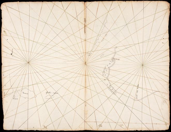
| View Original: | AMH-6040-NA_Map_of_the_coast_of_Lombok.jpg (2400x1860) | |||
| Download: | Original | Medium | Small | Thumb |
| Courtesy of: | commons.wikimedia.org | More Like This | ||
| Keywords: AMH-6040-NA Map of the coast of Lombok.jpg Artwork nl Kaart van de kust van Lombok nl Titel catalogus Leupe NA Kaart van de Kust van Lombok een gedeelte van Sumbawa enz Uit VOC 456 Behoort tot de tweede reis van Van Neck 1598-1600 Notities verso Lombok Rechtsonder bevindt zich de maatverhouding in mylen Topografische namen in het Maleis vermeld en Title in the Leupe catalogue NA Kaart van de Kust van Lombok een gedeelte van Sumbawa enz >From VOC 456 Comprises part of the second ship's voyage of Van Neck 1598-1600 Notes on reverse Lombok Bottom left the scale is given in mylen Topographical names are given in Malay Atlas of Mutual Heritage na http //www atlasofmutualheritage nl/en/object/ id 6040 Source at the Atlas of Mutual Heritage - http //www gahetna nl/collectie/archief/inventaris/index/eadid/4 VEL/inventarisnr/447/level/file Source at the Nationaal Archief en Subjects chart / map / plan nl Onderwerpen plattegrond / kaart Inscription - nl between 1598 1600 nl Anoniem / Anonymous en Anoniem / Anonymous Institution Nationaal Archief nl pen op papier en pen on paper Size cm 32 5 42 accession number NL-HaNA_4 VEL_447 old number VEL0447 PD-Art-100 1590s | ||||