MAKE A MEME
View Large Image

| View Original: | AMH-5650-KB Map of Japan.jpg (2400x1803) | |||
| Download: | Original | Medium | Small | Thumb |
| Courtesy of: | commons.wikimedia.org | More Like This | ||
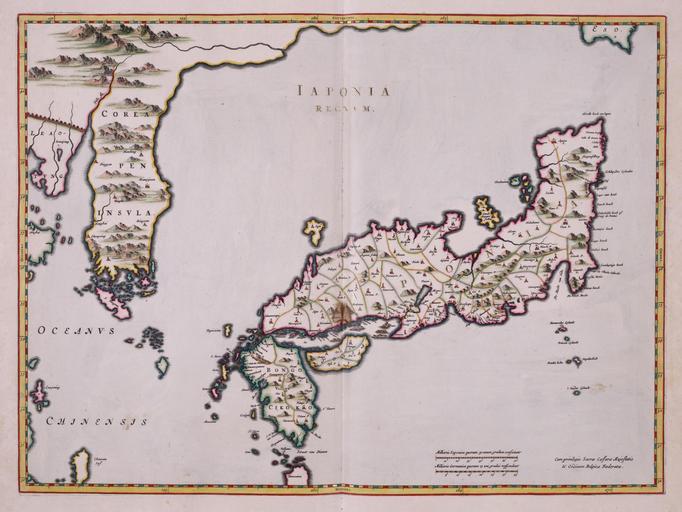
| Keywords: AMH-5650-KB Map of Japan.jpg Artwork nl Kaart van Japan nl Kaart van Japan uit de Atlas van der Hagen Koninklijke Bibliotheek Den Haag Deel 4 Deze kaart van Japan en Korea werd in 1655 gepubliceerd in de Atlas Sinensis van Joan Blaeu 1598-1673 Het bijzondere aan deze kaart samengesteld door de Italiaanse missionaris Martino Martini 1614-1661 is dat de omtrekken van Japan betrouwbaar zijn weergegeven terwijl ook Korea voor het eerst correct als een schiereiland is getekend Deze kaart was het prototype voor al de kaarten die in de 17de eeuw van dit gebied werden samengesteld en Map of Japan taken from the Atlas van der Hagen Koninklijke Bibliotheek The Hague Part 4 This map of Japan and Korea was published in 1655 by Joan Blaeu 1598-1673 in the Atlas Sinensis The striking thing about this map rendered by the Italian missionary Martino Martini 1614-1661 is that the contours of Japan have been accurately represented while Korea is also shown correcty for the first time as a peninsula This map constituted the prototype for all the charts of this region compiled in the 17th century Atlas of Mutual Heritage kb http //www atlasofmutualheritage nl/en/object/ id 5650 Source at the Atlas of Mutual Heritage en Subjects chart / map / plan nl Onderwerpen plattegrond / kaart Inscription IAPONIA REGNVM nl 1655 Creator Martino Martini nl Martino Martini gewerkt naar en Martino Martini copied after Institution Koninklijke Bibliotheek nl koperdruk op papier en copperplate printing on paper Size cm 42 56 accession number 1049B13_054 PD-Art-100 Maps of the Dutch East India Company - Japan Maps of the Dutch East India Company - Korea 1655 | ||||