MAKE A MEME
View Large Image
| View Original: | AMH-5530-NA_Map_of_the_north_coast_of_Java,_from_Geertruys_Island_to_Brenong.jpg (2400x1268) | |||
| Download: | Original | Medium | Small | Thumb |
| Courtesy of: | commons.wikimedia.org | More Like This | ||
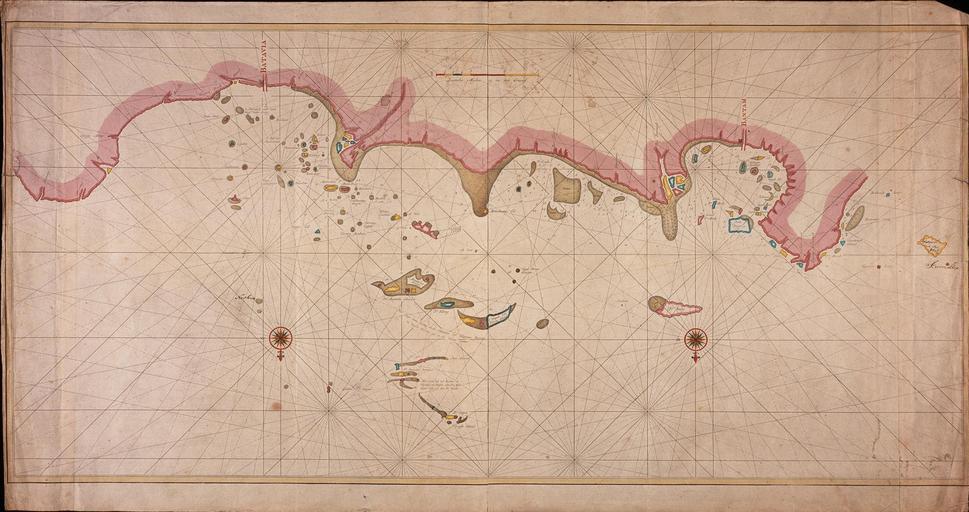
| Keywords: AMH-5530-NA Map of the north coast of Java, from Geertruys Island to Brenong.jpg Artwork nl Kaart van de noordkust van Java van Geertruys Eiland tot aan Brenong nl Titel catalogus Leupe NA Kaart als voren van Geertruys Eiland tot aan Brenong met 'Kaart als voren' wordt bedoeld de titel van VEL0374 Kaart van de Noordkust van Java De kaart is op blauw papier geplakt Notities verso XXXVII en Title in the Leupe catalogue NA Kaart als voren van Geertruys Eiland tot aan Brenong 'Kaart als voren' 'Chart as before' refers to the title of VEL0374 Kaart van de Noordkust van Java The map has been pasted onto blue paper Notes on reverse XXXVII Atlas of Mutual Heritage na http //www atlasofmutualheritage nl/en/object/ id 5530 Source at the Atlas of Mutual Heritage - http //www gahetna nl/collectie/archief/inventaris/index/eadid/4 VEL/inventarisnr/376/level/file Source at the Nationaal Archief en Subjects compass / dial chart / map / plan nl Onderwerpen kompas / windroos plattegrond / kaart en Post this image is related to a VOC trading post called http //www atlasofmutualheritage nl/en/post/ id 317 Banten Inscription - nl between 1740 1770 Creator Jan van Jagen nl Jan van Jagen graveur / etser en Jan van Jagen engraver / etcher Institution Nationaal Archief nl koperdruk op papier en copperplate printing on paper Size cm 62 116 5 accession number NL-HaNA_4 VEL_376 old number VEL0376 PD-Art-100 Maps of the Dutch East India Company - Indonesia Jan van Jagen | ||||