MAKE A MEME
View Large Image
| View Original: | Alte_Karte_von_Wilmersdorf.jpg (2592x1944) | |||
| Download: | Original | Medium | Small | Thumb |
| Courtesy of: | commons.wikimedia.org | More Like This | ||
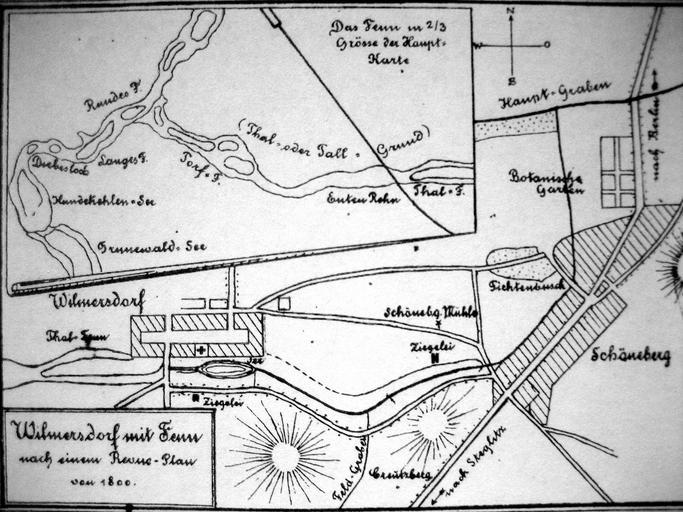
| Keywords: Alte Karte von Wilmersdorf.jpg en Old map of the districts of Berlin-Wilmerdorf and Grunewald with moor/fen areas de Alte Karte mit Moorgebieten von Berlin-Wilmersdorf und Grunewald im Museum Charlottenburg-Wilmersdorf abfotografiert Author 1774 PD-old-100 Maps of Berlin-Wilmersdorf Historical maps of Bezirk Charlottenburg-Wilmersdorf Grunewaldseenkette Fennsee Berlin-Wilmersdorf | ||||