MAKE A MEME
View Large Image

| View Original: | Alta2004.PNG (1088x1300) | |||
| Download: | Original | Medium | Small | Thumb |
| Courtesy of: | commons.wikimedia.org | More Like This | ||
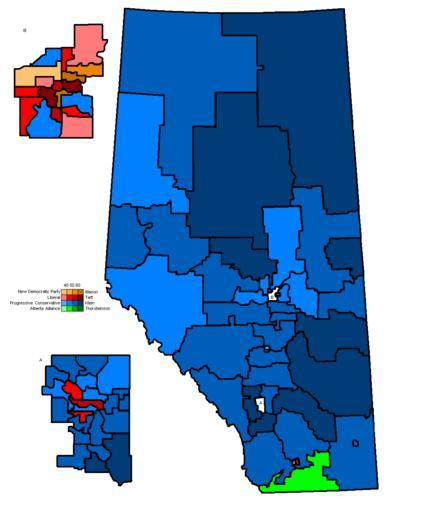
| Keywords: Alta2004.PNG Alberta spatial logic map Alta election 2004 - map created by me This is a note to everyone doing the image stuff Any maps or photos I have uploaded are <nowiki></nowiki> except for photos of politicians which are <nowiki> CanadaCopyright </nowiki> if they are MPs or <nowiki> OntarioCopyright </nowiki> if they are MPPs; or logos which are <nowiki> logo </nowiki> Thank you all posts on my talk page about image tags will be ignored I have learned my lesson I will tag everything from now on Cheers Earl Andrew 03 45 14 Dec 2004 UTC Alberta provincial election maps en wikipedia Rehman CommonsHelper 2004-11-24 Earl Andrew wikipedia en Earl Andrew Original upload log page en wikipedia Alta2004 PNG 2008-11-06 21 04 Noname2 962×1322× 60768 bytes <nowiki>Better map</nowiki> 2005-10-21 23 36 MS123 1088×1300× 26213 bytes <nowiki></nowiki> 2005-03-15 09 17 Earl Andrew 962×1322× 60768 bytes <nowiki>fixed riding switch brightened NDP colours</nowiki> 2004-11-24 04 49 Earl Andrew 962×1322× 60805 bytes <nowiki>Alberta spatial logic map Alta election 2004 - map created by me</nowiki> 2004 maps of Canada Maps of Alberta provincial electoral districts | ||||