MAKE A MEME
View Large Image
| View Original: | Alberta flood rainfall map 19-22 June 2013.png (1740x1604) | |||
| Download: | Original | Medium | Small | Thumb |
| Courtesy of: | commons.wikimedia.org | More Like This | ||
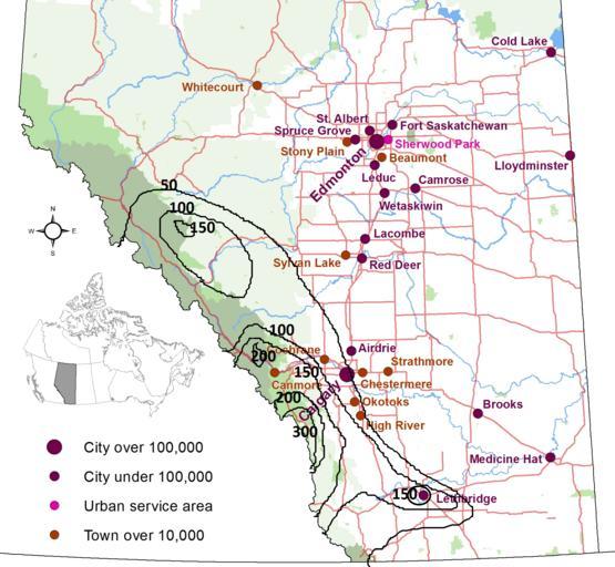
| Keywords: Alberta flood rainfall map 19-22 June 2013.png en Rainfall map in mmillimeters from 19 to 22 of June 2013 over Southern Alberta causing widespread flood This map has been done using File AB Cities jpg and data from http //environment alberta ca/forecasting/data/precipmaps/event pdf June 19 to June 26 2013 - Accumulated Precipitation with data from http //environment alberta ca/forecasting/data/precipmaps/precipmaps html Alberta Environment own Pierre cb 2013-06-23 Cc-zero 2013 Alberta flood 2013 maps of Canada | ||||