MAKE A MEME
View Large Image

| View Original: | Abraham_Ortelius._Palestinae_Sive_Totius_Terrae_Promissionis_Nova_Descriptio_Auctore_Tilemanno_Stella_Sigenens._1572.jpg (1869x1400) | |||
| Download: | Original | Medium | Small | Thumb |
| Courtesy of: | commons.wikimedia.org | More Like This | ||
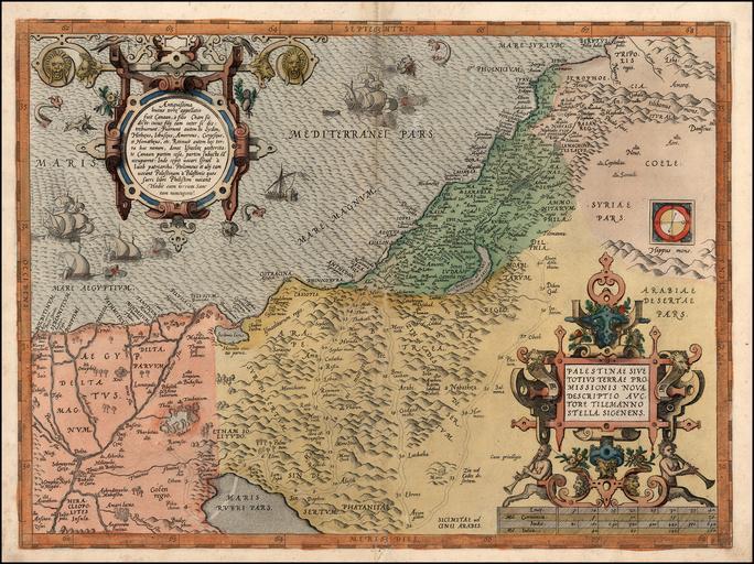
| Keywords: Abraham Ortelius. Palestinae Sive Totius Terrae Promissionis Nova Descriptio Auctore Tilemanno Stella Sigenens. 1572.jpg Artwork Creator Abraham Ortelius en A nice example of Ortelius' map of the Holy Land from the 1572 German edition of his Theatrum Orbis Terrarum the first modern atlas <br /> The map shows all of the Holy Lands with Egypt In the upper left is a text box describing the region In the bottom right is a fine title cartouche with mileage scale below it Five sailing ships and a sea monster in the ocean <br /> References Van Den Broecke 170 1572 in 18 13 5 Antwerp accession number object history credit line http //www raremaps com/gallery/detail/20157/Palestinae_Sive_Totius_Terrae_Promissionis_Nova_Descriptio_Auctore/Ortelius html www raremaps com 250px 1584 version 250px 1595 version Old maps of Israel 1572 Old maps of the Holy Land 1572 Maps of Palestine Maps by Abraham Ortelius 1572 maps Ships on maps Maps in Latin Old maps of Egypt Old maps of Jordan Old maps of the Nile Maps of river deltas PD-Art-100 ImageNote 1 762 488 145 117 1869 1400 2 Mare Magnvm ImageNoteEnd 1 ImageNote 2 822 645 42 51 1869 1400 2 Anthedon ImageNoteEnd 2 ImageNote 3 906 591 65 23 1869 1400 2 Ascalon ImageNoteEnd 3 | ||||