MAKE A MEME
View Large Image
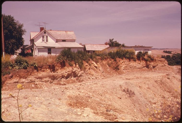
| View Original: | ABANDONED_FARMHOUSE_AND_OUT_BUILDINGS_ARE_SURROUNDED_BY_COAL_COMPANY_STRIP_MINED_LAND_OFF_ROUTE_^800_NEAR..._-_NARA_-_555611.jpg (3000x2024) | |||
| Download: | Original | Medium | Small | Thumb |
| Courtesy of: | commons.wikimedia.org | More Like This | ||
| Keywords: ABANDONED FARMHOUSE AND OUT BUILDINGS ARE SURROUNDED BY COAL COMPANY STRIP MINED LAND OFF ROUTE ^800 NEAR... - NARA - 555611.jpg Scope and content General notes 555611 Local identifier 412-DA-13159 Environmental Protection Agency 12/02/1970 - NARA-Author Calonius Erik Photographer 8464439 <br /> Barnesville Ohio 3365782 39 983 -81 167 <br /> Still Picture Records Section Special Media Archives Services Division NWCS-S National Archives at College Park 8601 Adelphi Road College Park MD 20740-6001 07/1974 Record group Record Group 412 Records of the Environmental Protection Agency 1944 - 2006 Record group ARC 708 DOCUMERICA The Environmental Protection Agency's Program to Photographically Document Subjects of Environmental Concern compiled 1972 - 1977 Series ARC 542493 File unit File unit ARC Variant control numbers Agency-Assigned Identifier 220/19/013159<br /> NAIL Control Number NWDNS-412-DA-13159 Other versions <gallery> File ABANDONED_FARMHOUSE_AND_OUT_BUILDINGS_ARE_SURROUNDED_BY_COAL_COMPANY_STRIP_MINED_LAND_OFF_ROUTE_ 800_NEAR _-_NARA_-_555611 tif tif File ABANDONED_FARMHOUSE_AND_OUT_BUILDINGS_ARE_SURROUNDED_BY_COAL_COMPANY_STRIP_MINED_LAND_OFF_ROUTE_ 800_NEAR _-_NARA_-_555611 jpg jpg </gallery> NARA-cooperation PD-USGov Abandoned houses in the United States | ||||