MAKE A MEME
View Large Image
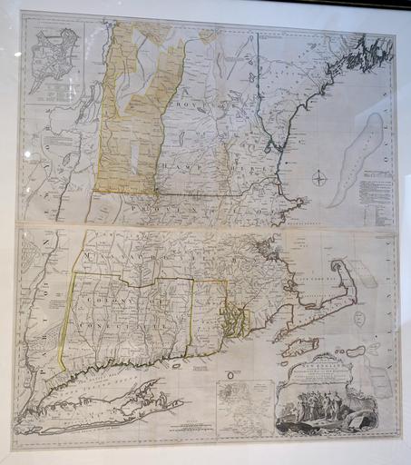
| View Original: | A Map of the Most Inhabited Part of New England, by Thomas Jefferys, London, England, printed by William Faden, 1774 - Bennington Museum - Bennington, VT - DSC08732.JPG (-3235x3653) | |||
| Download: | Original | Medium | Small | Thumb |
| Courtesy of: | commons.wikimedia.org | More Like This | ||
| Keywords: A Map of the Most Inhabited Part of New England, by Thomas Jefferys, London, England, printed by William Faden, 1774 - Bennington Museum - Bennington, VT - DSC08732.JPG en Exhibit in the Bennington Museum - Bennington Vermont USA This work is in the public domain because the artist died more than 70 years ago Photography was permitted in the museum without restriction 2015-02-28 13 27 21 own Daderot other versions PD-old-70 cc-zero Collections of the Bennington Museum Thomas Jefferys | ||||