MAKE A MEME
View Large Image

| View Original: | 2010unitedstatespopulationdensity.svg (3503x1788) | |||
| Download: | Original | Medium | Small | Thumb |
| Courtesy of: | commons.wikimedia.org | More Like This | ||
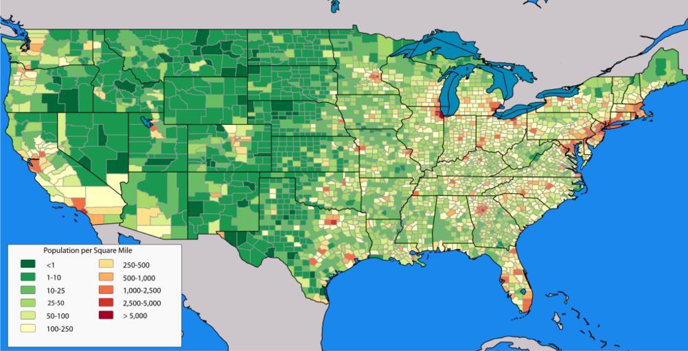
| Keywords: 2010unitedstatespopulationdensity.svg en A map of the population density of the United States down to county level based on 2010 Census data County shapefiles provided by 2010 Census TIGER/Line Shapefiles Other shapefiles provided by Natural Earth 2011-09-16 own Crimsonedge34 other fields A + QGIS v n Maps cc-zero Uploaded with UploadWizard Population density maps of the United States | ||||