MAKE A MEME
View Large Image
| View Original: | 2008-06-14 NOAA flooding overview.png (531x371) | |||
| Download: | Original | Medium | Small | Thumb |
| Courtesy of: | commons.wikimedia.org | More Like This | ||
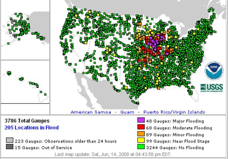
| Keywords: 2008-06-14 NOAA flooding overview.png en A map showing all observed locations for water level in the United States on June 14 2008 during historic flooding in the Midwest Yellow is near flood stage orange is minor flooding red moderate flooding and purple major flooding Green denotes no flooding National Oceanic and Atmospheric Administration NOAA http //www weather gov/images/ahps/national/conus_all_obs png Original image National Oceanic and Atmospheric Administration NOAA 2008-06-14 See license; Public domain PD-USGov-DOC-NOAA PD-USGov June 2008 Midwest floods | ||||