MAKE A MEME
View Large Image
| View Original: | 2007SanDiegoFiresradar1008z.PNG (829x518) | |||
| Download: | Original | Medium | Small | Thumb |
| Courtesy of: | commons.wikimedia.org | More Like This | ||
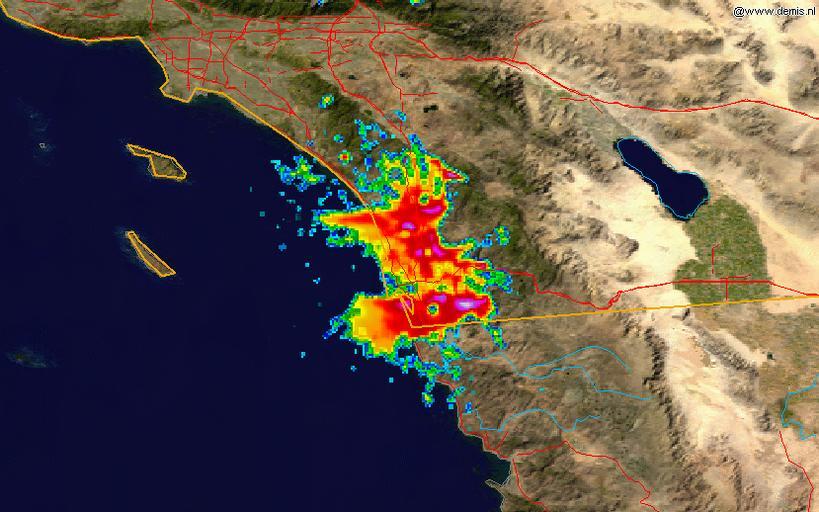
| Keywords: 2007SanDiegoFiresradar1008z.PNG This radar image shows the smoke plume from the southern California fires of 2007 on 2007-10-23 at 10 08 UTC overlain on a map The data is from the NWS NEXRAD radar at KNKX San Diego and was processed in the NCDC's http //www ncdc noaa gov/oa/radar/jnx/ JAVA NEXRAD tool Radar data is from the http //www ncdc noaa gov/nexradinv/ NCDC NEXRAD database and the background map is from the NASA 2007-10-26 Background map by NASA Radar data from NCDC Image created by Hello32020 PD-USGov-NOAA PD-USGov-NASA Hello32020 Radar images of smoke | ||||