MAKE A MEME
View Large Image

| View Original: | 2006 North Korean nuclear test mk.svg (473x408) | |||
| Download: | Original | Medium | Small | Thumb |
| Courtesy of: | commons.wikimedia.org | More Like This | ||
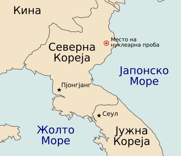
| Keywords: 2006 North Korean nuclear test mk.svg en Map of the North Korean nuclear test of October 9 2006 The red marker indicates the estimated location of the test 41 311┬░N 129 114┬░E mk ą ąĄčüč鹊č鹊 ąĮą░ ąĮčāą║ą╗ąĄą░č ąĮą░čéą░ ą┐č ąŠą▒ą░ ą▓ąŠ ąĪąĄą▓ąĄč ąĮą░ ąÜąŠč ąĄčśą░ Based off of maps from the CIA World Factbook translated from this translated by MacedonianBoy File 2006 North Korean nuclear test svg Maps of North Korea SVG maps in Macedonian SVG maps showing history in Macedonian | ||||