MAKE A MEME
View Large Image
| View Original: | 1920_Leconte_Pocket_Map_of_Paris,_France_(_with_Eiffel_Tower_and_Metro)_-_Geographicus_-_Paris-leconte-1820.jpg (5000x3732) | |||
| Download: | Original | Medium | Small | Thumb |
| Courtesy of: | commons.wikimedia.org | More Like This | ||
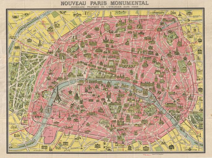
| Keywords: 1920 Leconte Pocket Map of Paris, France ( with Eiffel Tower and Metro) - Geographicus - Paris-leconte-1820.jpg A later example of the famous Nouveau Paris Monumental tourist pocket map of Paris Covers Paris from the Bois de Boulogne to the Bois de Vincennes Monuments and important buildings are shown in relief - including the Eiffel Tower Also shows roadways and Metro lines Though undated the state of development of the Paris Metro particularly the extension of the 11 suggests that this map must have been printed around 1920 - 1925 Verso offers a similar map of the greater Paris area extending as far as Chartres Bray Vignes and Beauvais 1920 undated Size in 27 21 object history credit line accession number Paris-leconte-1820 Geographicus-source PD-art Maps of Paris in the 20th century Maps of landmarks in Paris 1920 maps 1920 in Paris 20th-century maps of Paris | ||||
_-_Geographicus_-_Paris-leconte-1820.jpg)