MAKE A MEME
View Large Image

| View Original: | 1920 California state highways.svg (576x672) | |||
| Download: | Original | Medium | Small | Thumb |
| Courtesy of: | commons.wikimedia.org | More Like This | ||
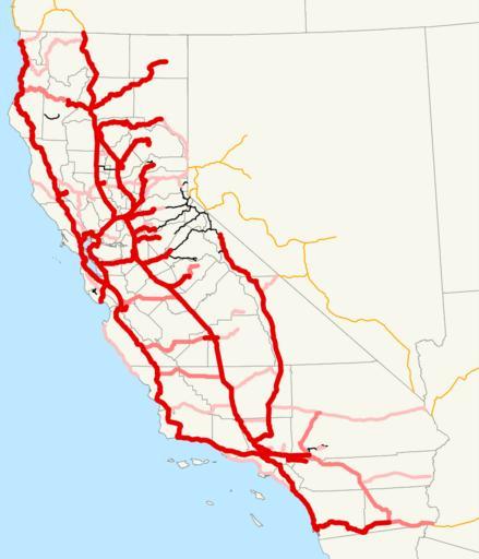
| Keywords: 1920 California state highways.svg This is a map of California's state highway system constructed and proposed routes as it existed in 1920 Routes are color-coded by how they were added red for the bond issues 1910 1916 1919 with the darkest red in 1910 and black for roads added by legislative acts 1895-1919 If a road was legislated but also in a bond issue it is shown as red Email me if you would like a copy of the GIS data I created for the highways 2007-12-03 own assumed NE2 Maps of California's state highway system | ||||