MAKE A MEME
View Large Image
| View Original: | 1900_U.S.G.S._Map_of_Oyster_Bay,_Long_Island,_New_York_-_Geographicus_-_OysterBay-uscs-1925.jpg (3000x3907) | |||
| Download: | Original | Medium | Small | Thumb |
| Courtesy of: | commons.wikimedia.org | More Like This | ||
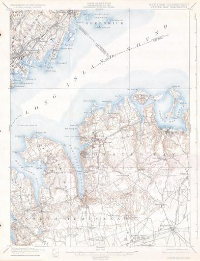
| Keywords: 1900 U.S.G.S. Map of Oyster Bay, Long Island, New York - Geographicus - OysterBay-uscs-1925.jpg This beautiful and fascinating topographical chart depicts the Long Island New York region of Oyster Bay including North Hempstead and across the Long Island Sound parts of Mamaroneck Harrison and Rye Highly detailed with important buildings and trains and rail lines A rare and stunning geological survey of this highly populated region From the 1928 reissue of the Feb 1900 charts 1900 Size in 19 15 object history credit line accession number OysterBay-uscs-1925 Geographicus-source PD-art Oyster Bay New York Old maps of New York | ||||