MAKE A MEME
View Large Image
| View Original: | 1890_Bacon_Traveler's_Pocket_Map_of_London,_England_-_Geographicus_-_London-bacon-1890.jpg (6000x4598) | |||
| Download: | Original | Medium | Small | Thumb |
| Courtesy of: | commons.wikimedia.org | More Like This | ||
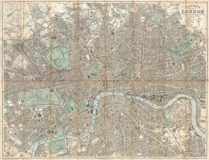
| Keywords: 1890 Bacon Traveler's Pocket Map of London, England - Geographicus - London-bacon-1890.jpg An extremely attractive c 1890 traveler's pocket map of Victorian London England Covers central London on a scale of four inches to the mile - from West Kensington in the west across to the West India Docks in the east and from Hampstead down to North Brixton and Camberwell Offers extraordinary detail throughout noting streets trains ferries docks and important buildings Parks are particularly well produced with superb detail on the interior Concentric circles radiate out from Charing Cross to indicate half mile distances from the city center Published by George Washington Bacon of 127 Strand London 1890 undated Size in 33 25 object history credit line accession number London-bacon-1890 Bacon G W <i>Bacon's New Shilling Map of London and Illustrated Guide With a Large Scale Plan of the City A Railway Map of the Environs Street Directory Cab Fares Co </i> 1890 Geographicus-source PD-old-auto 1922 Old maps of London 1890 maps George Washington Bacon | ||||