MAKE A MEME
View Large Image
| View Original: | 1887_Pocket_Map_Version_of_the_U.S._Geological_Survey_Map_of_western_Nantucket,_Massachusetts_-_Geographicus_-_Muskeget-usgs-1887.jpg (3064x4000) | |||
| Download: | Original | Medium | Small | Thumb |
| Courtesy of: | commons.wikimedia.org | More Like This | ||
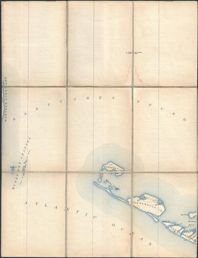
| Keywords: 1887 Pocket Map Version of the U.S. Geological Survey Map of western Nantucket, Massachusetts - Geographicus - Muskeget-usgs-1887.jpg This is a rare example of the c 1887 U S Geological Survey map of the Muskeget Channel Extends eastward from Marthas Vineyard to include Muskeget Island Tuckernuck Island and the eastern parts of Nantucket Offers copious topographical detail as well as some submarine detail as well as towns roads and some individual buildings This map was originally dissected and mounted on linen by the Old Corner Book Store of 27-29 Bromfield Street in Boston Massachusetts 1887 undated Size in 13 75 17 75 object history credit line accession number Muskeget-usgs-1887 Prepared in this format by the Old Corner Book Store 27-29 Bromfield Street Boston Geographicus-source PD-art Old maps of Massachusetts 1887 maps Old maps of Nantucket | ||||