MAKE A MEME
View Large Image
| View Original: | 1881_Lefevre_Pocket_Map_or_Plan_of_Paris,_France_-_Geographicus_-_Paris-lefevre-1881.jpg (5000x3765) | |||
| Download: | Original | Medium | Small | Thumb |
| Courtesy of: | commons.wikimedia.org | More Like This | ||
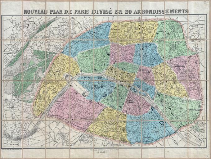
| Keywords: 1881 Lefevre Pocket Map or Plan of Paris, France - Geographicus - Paris-lefevre-1881.jpg An extremely attractive 1881 decorative pocket map of Paris in 20 arrondissements by the French publisher Theodore Lefevre Covers the old walled city of Paris and surrounding areas including the Bois de Boulogne Geared toward the tourist market this map notes all streets parks railways and numerous important buildings and monuments Hand colored in an attractive range of pastels 1881 dated Size in 36 5 27 5 object history credit line accession number Paris-lefevre-1881 Geographicus-source PD-art Maps of Paris in the 19th century 19th-century maps of Paris Old locator maps of arrondissements of Paris 1881 maps 1881 in Paris | ||||