MAKE A MEME
View Large Image
| View Original: | 1878_Migeon_Map_of_the_British_Isles_(_England,_Ireland,_Scotland_)_-_Geographicus_-_BritishIsles-migeon-1878.jpg (2000x2810) | |||
| Download: | Original | Medium | Small | Thumb |
| Courtesy of: | commons.wikimedia.org | More Like This | ||
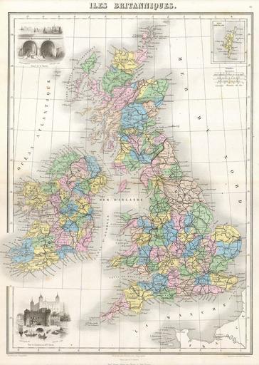
| Keywords: 1878 Migeon Map of the British Isles ( England, Ireland, Scotland ) - Geographicus - BritishIsles-migeon-1878.jpg This hand colored map of the British Isles is a steel plate engraving dating to 1878 by the well regarded French cartographer Migeon It includes England Scotland Ireland and Wales Migeon ™s Geographie Universelle published in Paris is one of the last fine atlases produced in the 19th century It contains many stylistic elements of early 19th century cartography such as full hand coloring numerous decorative vignettes and high quality low acid paper 1878 Size in 11 16 object history credit line accession number BritishIsles-migeon-1878 Geographicus-source PD-art Old maps of the British Isles 1878 maps | ||||
_-_Geographicus_-_BritishIsles-migeon-1878.jpg)