MAKE A MEME
View Large Image
| View Original: | 1878_Meiji_11_Ino_Tadataka_Japanese_Military_Map_of_Japan_-_Geographicus_-_Japan-ino-1878.jpg (1885x1782) | |||
| Download: | Original | Medium | Small | Thumb |
| Courtesy of: | commons.wikimedia.org | More Like This | ||
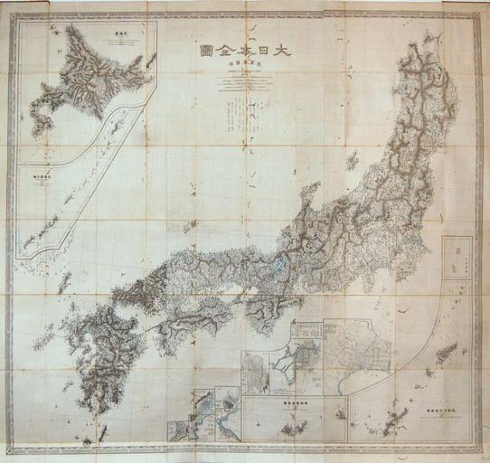
| Keywords: 1878 Meiji 11 Ino Tadataka Japanese Military Map of Japan - Geographicus - Japan-ino-1878.jpg This is a stunning Meiji 11 or 1878 pocket or folding map of Japan Based on survey work performed by the legendary Ino Tadataka during the Edo Period this map reflects the stunning detail inherent to Tadataka maps Covers Japan in full with thirteen insets detailing Hokkaido Edo Tokyo the smaller Japanese Islands and several important Japanese cities This map was issued in the Meiji era for use by the Japanese military 1878 dated Size in 45 25 48 object history credit line accession number Japan-ino-1878 Geographicus-source PD-art Maps in Japanese Old maps of Japan 1878 maps Ino Tadataka | ||||