MAKE A MEME
View Large Image
| View Original: | 1874_Mitchell_Map_of_Iowa_and_Missouri_-_Geographicus_-_IOMS-m-1874.jpg (2493x3000) | |||
| Download: | Original | Medium | Small | Thumb |
| Courtesy of: | commons.wikimedia.org | More Like This | ||
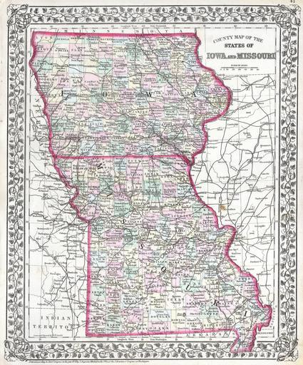
| Keywords: 1874 Mitchell Map of Iowa and Missouri - Geographicus - IOMS-m-1874.jpg This hand colored antique map of Iowa and Missouri is a lithographic engraving dating to 1874 by the legendary American map publisher Samuel Augustus Mitchell Jr Cities and towns are shown in considerable detail 1874 Size in 11 14 object history credit line accession number IOMS-m-1874 Geographicus-source PD-old-100 Maps by Samuel Augustus Mitchell Old maps of Iowa Old maps of Missouri 1874 maps | ||||