MAKE A MEME
View Large Image
| View Original: | 1873_Beers_Map_of_New_York_State_-_Geographicus_-_NewYork-beers-1873.jpg (4000x2732) | |||
| Download: | Original | Medium | Small | Thumb |
| Courtesy of: | commons.wikimedia.org | More Like This | ||
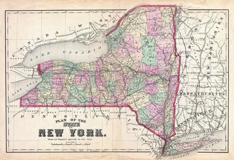
| Keywords: 1873 Beers Map of New York State - Geographicus - NewYork-beers-1873.jpg A scarce example of Fredrick W Beers ™ map of the state of New York State is depicted broken down into counties by color Includes parts of Massachusetts Connecticut Vermont New Hampshire and Pennsylvania as well as Lake Ontario and Lake Erie Prepared by Beers Comstock Cline out of their office at 36 Vesey Street New York City for inclusion in the first published atlas of Long Island the 1873 issue of Atlas of Long Island New York 1873 undated Size in 21 25 14 5 object history credit line accession number NewYork-beers-1873 <i>Atlas of Long Island New York From Recent Actual Surveys and Records Under the Superintendence of F W Beers </i> 1873 First Edition Geographicus-source PD-art Beers maps of Long Island published in 1873 | ||||