MAKE A MEME
View Large Image
| View Original: | 1872_Mitchell_Map_of_Prussia,_Germany_-_Geographicus_-_Prussia-mitchell-1872.jpg (3500x2796) | |||
| Download: | Original | Medium | Small | Thumb |
| Courtesy of: | commons.wikimedia.org | More Like This | ||
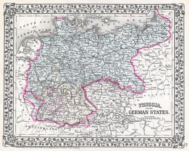
| Keywords: 1872 Mitchell Map of Prussia, Germany - Geographicus - Prussia-mitchell-1872.jpg A beautiful example of S A Mitchell Jr ™s 1872 map of Prussia and the German States issued shortly after the end of the Franco-Prussian War in 1871 Denotes both political and geographical details Divided according to regions and highlighted with Mitchell ™s typical pastels One of the most attractive American atlas maps of this region to appear in the mid 19th century Features the vine motif border typical of Mitchell maps from the 1866 - 1882 period Prepared by S A Mitchell for inclusion as plate no 65 in the 1872 issue of Mitchell ™s New General Atlas Dated and copyrighted Entered according to Act of Congress in the Year 1872 by S A Mitchell in the Office of the Librarian of Congress at Washington 1872 dated Size in 14 11 object history credit line accession number Prussia-mitchell-1872 Mitchell Jr S A <i>Mitchell's new general atlas containing maps of the various countries of the World plans of cities etc </i> 1872 edition Geographicus-source PD-old-100 Maps by Samuel Augustus Mitchell Old maps of Prussia Old maps of Germany 1872 maps | ||||