MAKE A MEME
View Large Image

| View Original: | 1870_Baur_and_Bromme_Map_of_the_World_on_Mercator_Projection_-_Geographicus_-_NeuesteKartederErde-baur-1870.jpg (6000x4557) | |||
| Download: | Original | Medium | Small | Thumb |
| Courtesy of: | commons.wikimedia.org | More Like This | ||
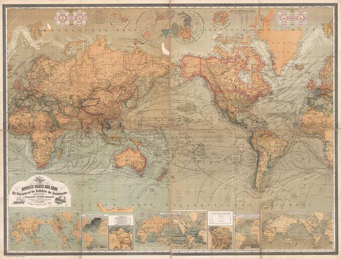
| Keywords: 1870 Baur and Bromme Map of the World on Mercator Projection - Geographicus - NeuesteKartederErde-baur-1870.jpg Artwork en A vastly complex and enormously proportioned c 1870 German map of the world by C F Baur and Traugott Bromme Printed in c 1870 in a multi-toned lithographic process this extraordinary map presents the world on a Mercator Projections Designed with a educational purposes in mind Baur manages to incorporate a staggering wealth of informative detail into ever corner of this map The world is depicted according to the political conventions of the late 19th century While most of the world had been explored by the late 19th century this map does offer some interesting speculative land masses in the Arctic including Gillis Land named after a c 1707 whaler who supposedly spotted it and a mysterious land mass to the northwest of the Behring Strait The Canadian Arctic is remarkable well mapped though the whole region is shows to be locked down in glacial ice In contrast Antarctic exploration was still in its infancy though parts of the Antarctic coast line are noted to the south of Australia and off the coast of Tierra del Fuego Throughout there is an attempt to map currents and wind patterns Various explorers routes including Cook Biscoe Tasman Wilkes Vancouver the Resolution Wallis Boupet Diego Alvarez Bligh Boulton and many others This also identifies the Saragasso Sea and another similar vortex in the Pacific The border regions of the map are occupied by a series of smaller maps and charts including polar projections an isothermal chart a winds chart an inset of Panama and Suez two weather charts and a magnetic variation chart The title cartouche appearing in the lower left quadrant shows a shop and a train as well as curious logo that seems to embraced the realms of navigation and science 1870 undated Size in 49 36 object history credit line accession number NeuesteKartederErde-baur-1870 Geographicus-source PD-art 1870 maps 1870s maps of the world Old maps with Mercator projection Maps in German Old weather and climate maps Global maps centered 180E Paris prime | ||||