MAKE A MEME
View Large Image
| View Original: | 1867_Ledot_Pocket_Map_of_Paris,_France_-_Geographicus_-_Paris-ledot-1867.jpg (6000x4110) | |||
| Download: | Original | Medium | Small | Thumb |
| Courtesy of: | commons.wikimedia.org | More Like This | ||
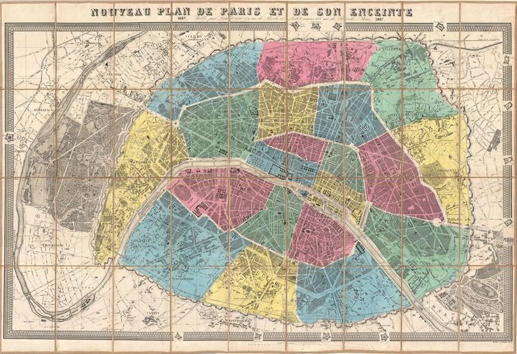
| Keywords: 1867 Ledot Pocket Map of Paris, France - Geographicus - Paris-ledot-1867.jpg A stunningly and mammothine folding map of Paris France dating to 1867 As the title suggests this is a New Map of Paris drawn to illustrate Napoleon III and Georges-Eugène Haussmann ™s revolutionary modernization of Paris Shows the 1860 repartitioning of the arrondissement system into 20 distinct zones as well as Haussmann ™s broad networks of avenues and thoroughfares Elegant highly detailed engraving reveals important buildings parks streets and fortifications Surrounded by a keyboard style border which is broken here and there to show the city ™s ring forts Dissected and mounted on linen in 36 panels for easy folding and unfolding Published by the Ledot Freres from their offices at 168 Rue de Rivoli Paris 1867 dated Size in 42 28 object history credit line accession number Paris-ledot-1867 Geographicus-source PD-art Maps of Paris in the 19th century 19th-century maps of Paris Old locator maps of arrondissements of Paris 1867 maps Paris in the 1860s | ||||