MAKE A MEME
View Large Image
| View Original: | 1866_Johnson_Map_of_Scotland_and_Ireland_-_Geographicus_-_ScotlandIreland-johnson-1866.jpg (4000x2629) | |||
| Download: | Original | Medium | Small | Thumb |
| Courtesy of: | commons.wikimedia.org | More Like This | ||
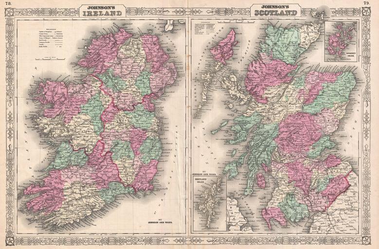
| Keywords: 1866 Johnson Map of Scotland and Ireland - Geographicus - ScotlandIreland-johnson-1866.jpg This is Johnson and Ward ™s 1866 map of Ireland and Scotland Essentially two maps on one sheet with the left hand map covering Ireland and the right hand map covering Scotland Both regions are divided into their constituent counties and districts with towns cities roads and railways noted The Scotland map features two insets detailing the Shetland and Orkney Islands respectively Surrounded by the fretwork style border common to Johnson ™s atlas maps issued between 1863 and 1869 Steel plate engraving prepared by A J Johnson for publication as plates no 78 and 79 in the 1866 edition of his New Illustrated Atlas ¦ This is the last edition of the Johnson ™s Atlas to bear the Johnson and Ward imprint 1866 dated 1865 Size in 23 5 17 5 object history credit line accession number s Geographical Statistical and Historic including The Latest Federal Census A Geographical Index and a Chronological History of the Civil War in America</i> last Johnson and Ward 1866 Geographicus-source PD-old-100 Maps by Alvin Jewett Johnson 1866 maps Old maps of Ireland Old maps of Scotland | ||||