MAKE A MEME
View Large Image
| View Original: | 1864_Johnson_Map_of_Florida_-_Geographicus_-_Florida-johnson-1864.jpg (4000x3206) | |||
| Download: | Original | Medium | Small | Thumb |
| Courtesy of: | commons.wikimedia.org | More Like This | ||
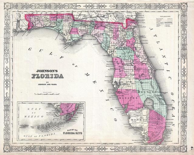
| Keywords: 1864 Johnson Map of Florida - Geographicus - Florida-johnson-1864.jpg This is Johnson and Ward ™s 1864 map of the Florida Details the stated divided by county showing towns roads railroads ports bays and internal lakes and waterways An inset map in the lower left quadrant details the Florida Keys Notes Miami Features the fretwork border common to Johnson ™s atlas work from 1864 to 1869 Steel plate engraving prepared by A J Johnson for publication as plate no 46 in the 1864 edition of his New Illustrated Atlas ¦ This is the last edition of the Johnson ™s Atlas to bear the Johnson and Ward imprint 1864 undated Size in 16 13 object history credit line accession number Florida-johnson-1864 <i>Johnson's New Illustrated Family Atlas</i> 1864 Johnson Ward Edition Geographicus-source PD-old-100 Maps by Alvin Jewett Johnson 1864 maps Old maps of Florida | ||||