MAKE A MEME
View Large Image
| View Original: | 1863_Henriot_Pocket_Map_of_Paris,_France_-_Geographicus_-_Paris-henriot-1863.jpg (6000x4166) | |||
| Download: | Original | Medium | Small | Thumb |
| Courtesy of: | commons.wikimedia.org | More Like This | ||
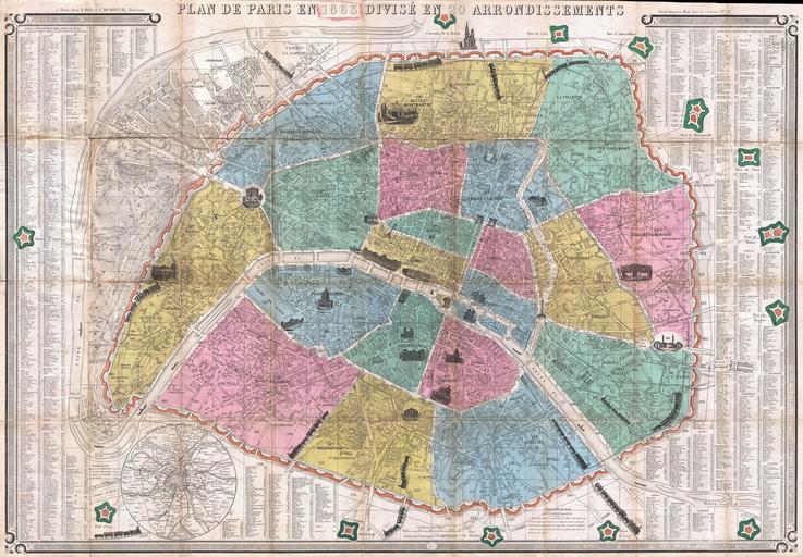
| Keywords: 1863 Henriot Pocket Map of Paris, France - Geographicus - Paris-henriot-1863.jpg This is an extremely attractive 1863 tourist pocket map of Paris France Covers the old walled city of Paris and the immediate vicinity Divided up into 20 arrondissments Important buildings are shown in profile Trains entering and leaving the city are also drawn in profile - a charming embellishment The fourteen forts surrounding Paris are all noted A street index with most major and minor streets labeled appears to the right and left of the map proper Several small boats ply the Seine A circular map of the Environs of Paris appears in the lower left quadrant Keyboard style border Prepared by J N Henriot for F Dubreuil in 1863 1863 dated Size in 34 23 5 object history credit line accession number Paris-henriot-1863 Geographicus-source PD-art Maps of Paris in the 19th century 19th-century maps of Paris Old locator maps of arrondissements of Paris 1863 maps 1863 in Paris | ||||