MAKE A MEME
View Large Image
| View Original: | 1862_Stieler_Map_o_Australia_and_Polynesia_-_Geographicus_-_Polynesien-perthes-1862.jpg (3236x2551) | |||
| Download: | Original | Medium | Small | Thumb |
| Courtesy of: | commons.wikimedia.org | More Like This | ||
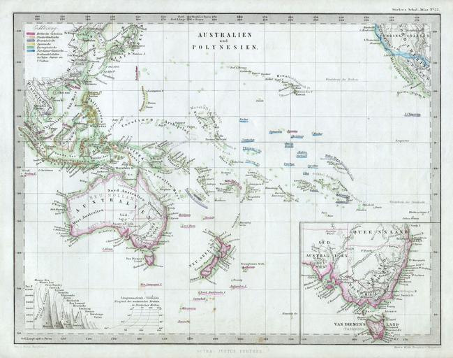
| Keywords: 1862 Stieler Map o Australia and Polynesia - Geographicus - Polynesien-perthes-1862.jpg This fascinating 1862 map by Justus Perthes and Stieler depicts Polynesia and Australia There is an inset of southeastern Australia and Tasmania On the bottom left there is a relative elevation chart Unlike other cartographic publishers of the period the Justus Perthes firm did not transition to lithographic printing techniques until the early 1870s Instead all of his maps are copper plate engravings and hence offer a level of character and depth of detail that was impossible to find in lithography or wax-process engraving All text in German Issued in the 1862 edition of Stieler ™s Schul-Atlas 1862 Size in 10 8 object history credit line accession number Polynesien-perthes-1862 Geographicus-source PD-old-100 Old maps showing history of Oceania | ||||