MAKE A MEME
View Large Image
| View Original: | 1861_Johnson_Map_of_Asia_-_Geographicus_-_Asia-johnson-1861.jpg (3000x2507) | |||
| Download: | Original | Medium | Small | Thumb |
| Courtesy of: | commons.wikimedia.org | More Like This | ||
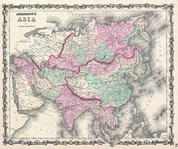
| Keywords: 1861 Johnson Map of Asia - Geographicus - Asia-johnson-1861.jpg This is Johnson and Browning ™s 1861 map of Asia first edition Covers the entire continent offering good inland detail even in Central Asia and northern China Includes parts of Europe the Arabian Peninsula and Africa Features the ribbon style border common to Johnson ™s atlas work from 1860 to 1862 Steel plate engraving prepared by A J Johnson for publication as plate no 82 in the 1861 edition of his New Illustrated Atlas ¦ This is the last edition of the Johnson ™s Atlas to bear the Johnson and Browning imprint 1861 undated Size in 15 75 12 5 object history credit line accession number Asia-johnson-1861 <i>Johnson's New Illustrated Steel Plate Family Atlas</i> 1861 Johnson and Browning edition Geographicus-source PD-old-100 Maps by Alvin Jewett Johnson 1861 maps Old maps of Asia | ||||