MAKE A MEME
View Large Image
| View Original: | 1860_Mitchell's_Map_of_Ohio_and_Indiana_-_Geographicus_-_INOH-m-63.jpg (2000x1610) | |||
| Download: | Original | Medium | Small | Thumb |
| Courtesy of: | commons.wikimedia.org | More Like This | ||
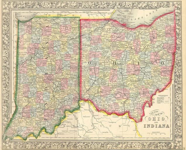
| Keywords: 1860 Mitchell's Map of Ohio and Indiana - Geographicus - INOH-m-63.jpg This hand colored map is a steel plate engraving dating to 1860 by the legendary American Mapmaker Samuel Augustus Mitchell It represents the states of Ohio Indiana 1860 Size in 13 5 11 object history credit line accession number INOH-m-63 Geographicus-source PD-old-100 Maps by Samuel Augustus Mitchell Old maps of Indiana Old maps of Ohio 1860 maps | ||||